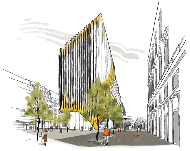
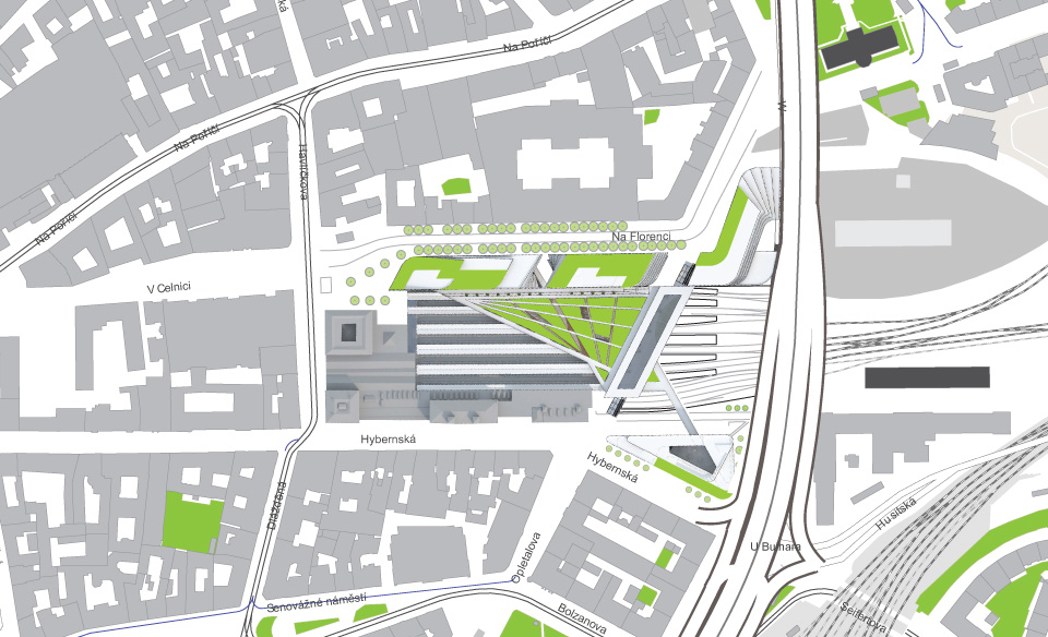
The story of Masaryk Station area

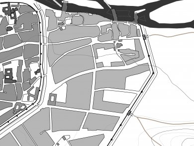
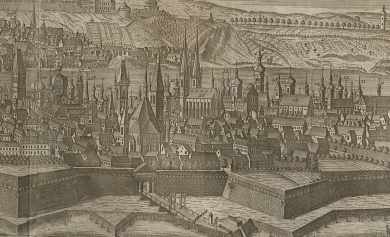
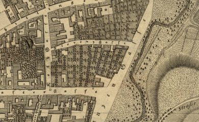
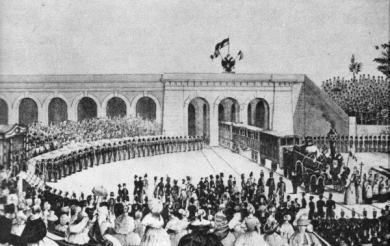
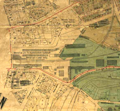
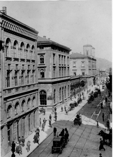
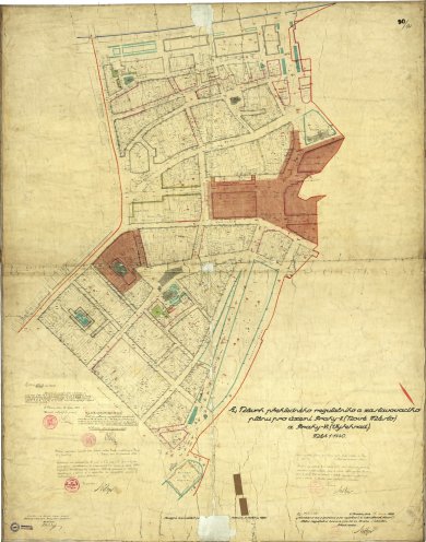
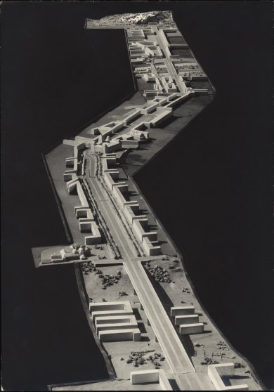
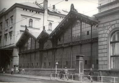
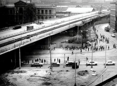
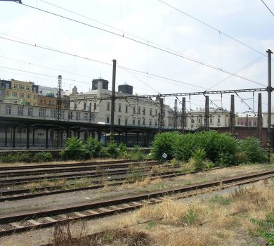
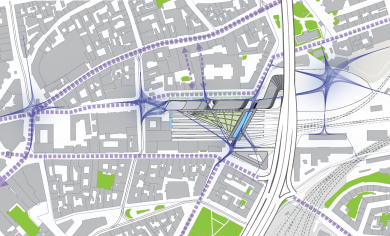
The contemporary appearance of the Masaryk Station locality was shaped by significant citywide interventions. The first was the emergence of the New Town of Prague and its fortifications. The second change, which determines the character of the territory even at present, was the establishment of the Prague State Railway Station in 1845 and its unique location both inside and outside the then city walls. The third major intervention was the construction of the North-South Highway (Severojižní magistrála) in the 1970s. The revitalization plan responds to this context. It preserves and strengthens the old values and deals with the problematic past interventions.

  • The territory became a part of the New Town of Prague. It was divided by the city walls, the existence of which significantly conditioned the future development of the area. While construction inside the city was taking place, outside the fortification walls, in the protective embankment, it was forbidden for strategic defensive reasons.

    New Town of Prague
  • The original medieval fortifications were replaced by new, bastion-style ones. At the same time, the city gates were shifted. The Mountain Gate (Horská brána), which originally ended Hybernská Street, was moved further to the South, and therefore Hybernská became a quiet street with palaces. The gate was also renamed the New Gate (Nová brána). Na Poříčí Street, ending with the Poříčská Gate (Poříčská brána), was a flourishing and busy street with many craft workshops and taverns.

    New baroque fortifications
  • In the open areas of the fortification walls, a promenade with cafés was established in the 1830s, offering breathtaking views of the Prague skyline and at the same time of the farmland in front of the walls, which at that time still existed there. The territory of the today's railway station was sparsely built and dominated by gardens. This was one of the reasons why this place was chosen for the construction of the station.

    Gardens and park promenade
  • Regular traffic was started at the first railway station in Prague on September 1, 1845. The location of the railway station and the railroads were designed by Jan Perner, the chief state railways engineer, while the appearance of the buildings by the architect Antonín Jüngling. Due to the limited space inside the city walls, the station was divided into the inner and outer part. This solution was unique in its time. From the outer, servicing part, trains moved to the inner part of the station through the gates in the city walls, which were locked overnight.

    Prague's first railway station
  • The railway station becomes the gateway for travellers to Olomouc, Vienna and also Dresden. The connection with Saxony was secured by the construction of the Negrelli Viaduct. From 1874, city walls got gradually demolished and trains no longer passed through the gates in the fortifications.

    Demolition of city walls
  • The operation of the station brings important institutions and businesses to its surroundings. A post office is set up in the vicinity and hotels and pubs set up for passengers appear close to a major traffic junction. The Customs House is connected to the railway by a railway siding on the route of today's V Celnici Street.

    Development of the area
  • In honour of the first president of Czechoslovakia, the railway station was renamed Masaryk Station as early as in 1919. Within the framework of its modernization, electrical track was built. In the regulatory plans, the idea of relocating the station and cancelling the original departure and arrival building appeared for the first time. At the station, a building block was to be built to fix the shifted street line of Na Florenci Street in the axis of the newly delimited V Celnici Street, and thus to extend the street network to the area of the cancelled freight railroad.

    The Masaryk Station gets its name
  • During the Second World War, grand plans were elaborated that would have significantly changed the appearance of the area. The Masaryk railway station was to be completely abolished, the Main Station moved under Vítkov and the area from north to south transformed into a wide city boulevard, the so-called North-South Transversal, bordered by lines of trees and new representative buildings. These plans were not implemented and the railway station was only renamed Prague – the Hybernian Station (Praha – Hybernské nádraží) in 1940.

    Unrealized plans
  • After the war, the station was given its original name, but as early as in 1953 the name changed again, to Prague – the Centre (Praha – Střed). Ten years later, steam operation was shut down, and trains with motor units appeared at the station. At that time, trains connecting Budapest, Prague and Berlin passed through it.

    End of steam railway
  • In the 1960s, under the influence of the growing car transport, the ideas of city planners were more oriented towards citywide transport solutions, which resulted, in 1974-1978, in the construction of a 220-metre bridge over the Masaryk Station as part of the so-called North-South Highway (Severojižní magistrála). It created a significant barrier in the area and clearly redefined the boundary between the New Town and Žižkov.

    Division of the area
  • In 1990, the railway station was renamed to Prague – the Masaryk Station (Praha – Masarykovo nádraží). Its importance gradually falls and the area lies out of focus. The definitive diversion of freight rail transport in the 1980s, the isolation from the Main Station (Hlavní nádraží) and the growing orientation towards road transport reopen the discussion of the importance of the Masaryk Station. Voices calling for its abolition reappear.

    Decline of the area
  • Between 2009 and 2014, several urban and architectural competitions were organized, relating to a new appearance of the area. In 2014, the plan by Zaha Hadid Architects was selected in an international competition. In 2015, the Ministry of Transport decided to preserve the Masaryk Station, when a project of the railway connection between the Václav Havel Airport and the city centre of Prague and Kladno, which will lead from the Masaryk Station, was approved.

    Searching for a new vision
  • From September 2017 to May 2018, extensive archaeological research was carried out in the area, relating to the prepared construction. The findings, which totalled over 240 thousand and filled 663 banana boxes, date mainly to the period from the 2nd half of the 14th century to the 17th century.

    Archaeological research

How the plan responds to the historical context

When preparing the plan, the history of the area served as an important source of information. The plan builds on the history of the site, protects its values and tries to remedy the current problems.

Restoring the original values of the area

1

In the plans of the roofing over the railway station, gardens are re-emerging. They were formerly located in a block inside the city walls on the site of the existing track.

2

The interconnection of Hybernská, Na Florenci and Na Poříčí Streets restores the promenade interconnection along the free areas of the city walls, dating to the 19th century.

3

At the time of its establishment, the station was proof of the modernization of the city and its economic progress. Likewise, the proposal now works with the demands of the 21st century: jobs in the new-economy sectors, strategic location on the transport hub, support for pedestrian links.

4

A part of the project is the reconstruction of the Masaryk Station period building and the protection of its historical values.

Responding to the current problems of the area

5

The North-South Highway is an important barrier in the area. The plan overcomes it and restores the connection between Prague 1 and Prague 3.

6

The transport character of the entire area has a negative impact on the quality of public spaces. The streets, the benches and the ground floor (parterre) of the buildings will be opened to the public and provide a wide range of shops and services.